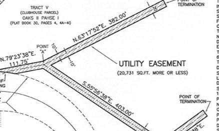
When an oil and gas company or utility company builds a subsurface pipeline or utility line, it is common to have the line shot in with GPS to mark the precise location of the line for future references. This not only provides the company with the exact location of the line installed, it also generates a certain amount of safety for future development. Having your buried lines marked and located with GPS will allow for you to create a Geospatial Information System (GIS) that contains all of the locational data for each line which takes out the guess work. This also allows for verification of the built line being contained within the easement created for the line.